Royal Thai Survey Department Documents Confirm Ta Moan Thom Temple Is Located in Cambodian Territory
 Royal Thai Survey Department Documents Confirm Ta Moan Thom Temple Is Located in Cambodian Territory
In territorial disputes between states, what carries greater weight than political assertions are legal documents, officially recognized maps, and the outcomes of boundary delimitation conducted by authorized bilateral commissions. Therefore, any discussion concerning sovereignty over Ta Moan Thom Temple should not be based on subjective interpretations or political rhetoric, but rather on verifiable evidence.
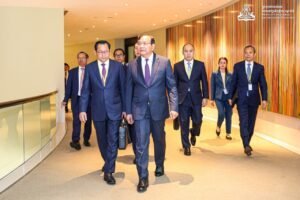
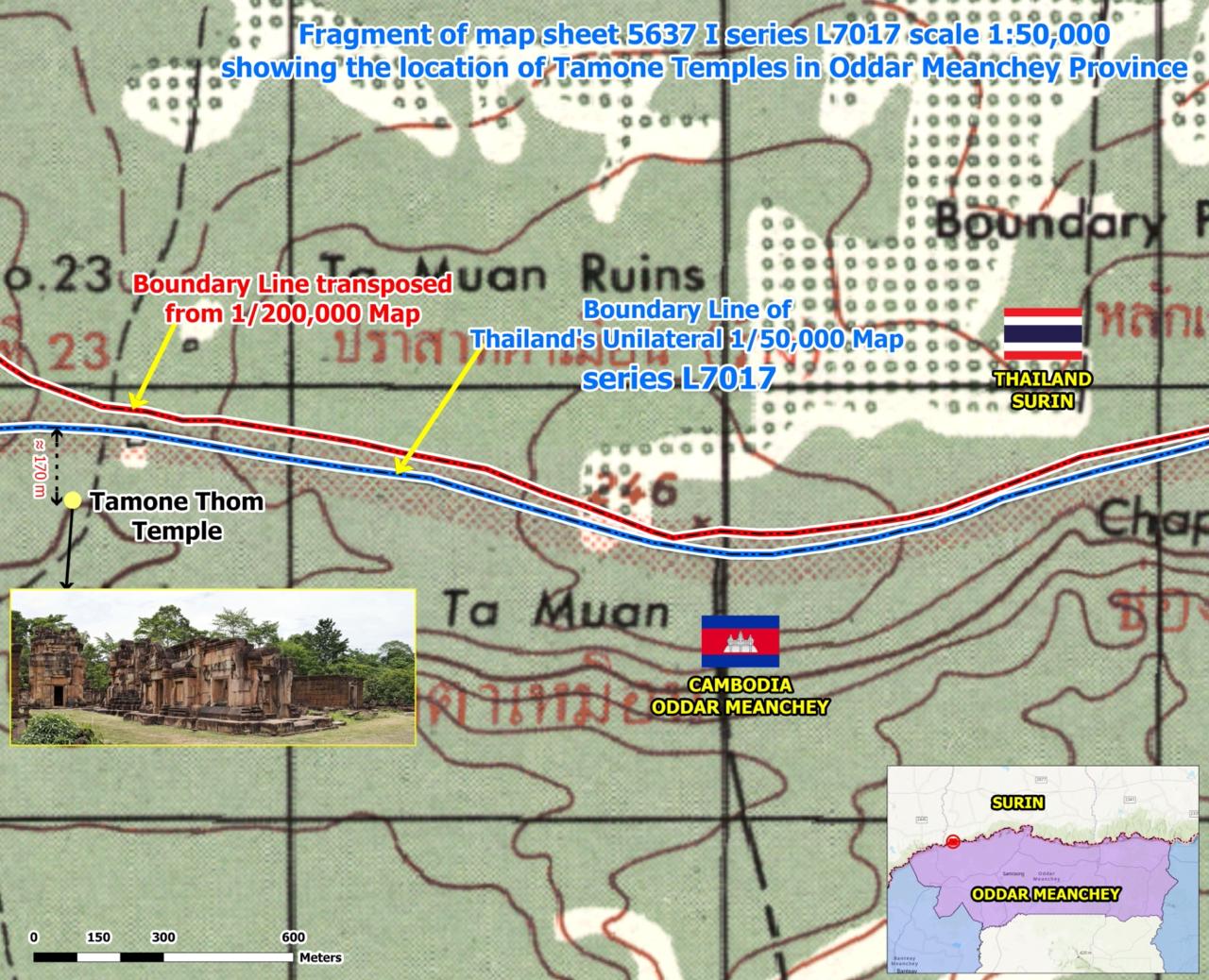
The remarks made by Mr. Ith Sothea, Permanent Secretary of State of Cambodia’s Secretariat of Border Affairs, present an important body of evidence worthy of careful consideration. He referred not only to the 1:200,000-scale map associated with the results of the Franco-Siamese boundary delimitation, but also to the 1:50,000-scale L7017 map produced by Thailand’s Royal Survey Department.
This point is particularly significant because even maps produced and officially used by Thailand itself indicate that Ta Moan Thom Temple is located within Cambodian territory. Consequently, attempts to reinterpret or advance claims contrary to this documentary evidence face serious credibility challenges and cannot alter the underlying facts.
Indeed, the topographical map attached to the 1908 survey records of the Franco-Siamese Boundary Commission also clearly identifies Ta Moan Thom Temple as lying within Cambodian territory. This document was neither created after the emergence of the present dispute nor prepared to support a contemporary legal position. Rather, it formed part of the official boundary delimitation process undertaken by the Franco-Siamese Boundary Commission and reflected results acknowledged by the parties at that time.
Even more noteworthy is the comparison between satellite imagery and the boundary line reproduced from the 1:200,000-scale map, together with the boundary line shown on the L7017 map. When these sources are overlaid and verified against one another, they consistently demonstrate that Ta Moan Thom Temple is situated within Cambodian territory. This indicates that modern geospatial technology has not altered the conclusions contained in the historical records; instead, it has further confirmed the temple’s actual geographical location.
Under international law, a map drawn unilaterally by one state cannot, by itself, create new sovereignty or alter an existing international boundary. Although such maps may possess evidentiary value in certain circumstances, they cannot supersede official documents that derive from bilateral agreements or from formal boundary delimitation processes jointly conducted by the parties concerned.
Accordingly, if there are attempts to draw a new boundary line in order to incorporate areas that Thailand currently occupies through what Cambodia characterizes as encroachment into Thai territory, contrary to the established historical and legal record, such an exercise would merely constitute a unilateral act without legal authority. Under the principles of international law, it cannot create new sovereign rights or invalidate the existing historical documents upon which the boundary has long been established.
Therefore, questions concerning the boundary and sovereignty over Ta Moan Thom Temple cannot be resolved through political statements or unilateral interpretations by either side. What carries genuine legal and evidentiary weight are historical records, official documents, and well-established principles of international law that are objective and capable of independent verification.
When the 1:200,000-scale map, the 1908 topographical map, and even the L7017 map produced by Thailand’s Royal Survey Department all point in the same direction—that Ta Moan Thom Temple lies within Cambodian territory—any subsequent interpretation contradicting these documentary sources is unlikely to gain recognition under the principles of international law.
For this reason, a durable and sustainable resolution of the boundary dispute should rest upon the original documentary record, the officially established results of the boundary delimitation process, and respect for international law, rather than upon attempts to construct new arguments based on unilateral boundary lines that, according to Cambodia’s position, stem from encroachment into Cambodian territory. Such unilateral acts cannot, in themselves, create sovereign rights or produce legal effects regarding territorial sovereignty.
By Pin Vichey
Political Science Scholar